

SOFTWARE DEVELOPMENT
What can we do for you?
Develop
new geoinformation systems based on satellite images (Earth Observation) and artificial intelligence.
Transform
your business in tourism, agriculture, telecommunications, or spatial planning.
Create
project documentation to get a geographic information system (GIS) adapted to your needs.
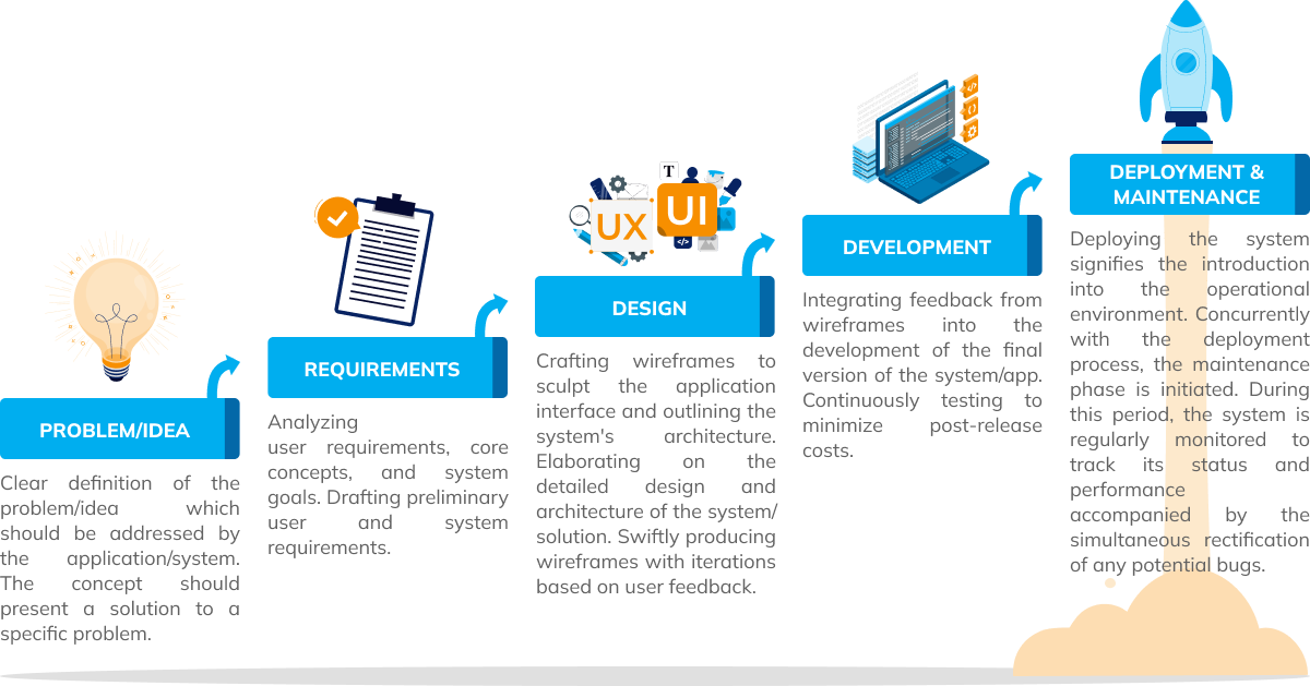


Analyzing user requirements, core concepts, and system goals. Drafting preliminary user and system requirements.

Crafting wireframes to sculpt the application interface and outlining the system’s architecture. Elaborating on the detailed design and architecture of the system/solution. Swiftly producing wireframes with iterations based on user feedback.