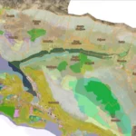
The goal was to establish topographic maps’ cartographic production of different scales and create services for serving vector data and finished cartographic products. In the complete scope of the project, LIST LABS participated as support in the creation of individual components.
Client:
DGUYear:
2019./2020.
LIST LABS participated as a support in the creation of certain system components, namely:
-
Proposal creation for the specifications of individual system’s components
-
Conceptual, logical, and physical data models creation for the production topographic and cartographic databases establishment
-
Automation of production procedures within the individual system components (model and cartographic generalizations and mapping)
-
Automation of symbolization and processed data cartographic interpretation
-
Supervision of project implementation


